Why is Map Knowledge Necessary to Overcome the Fear of Getting Lost in Nature?
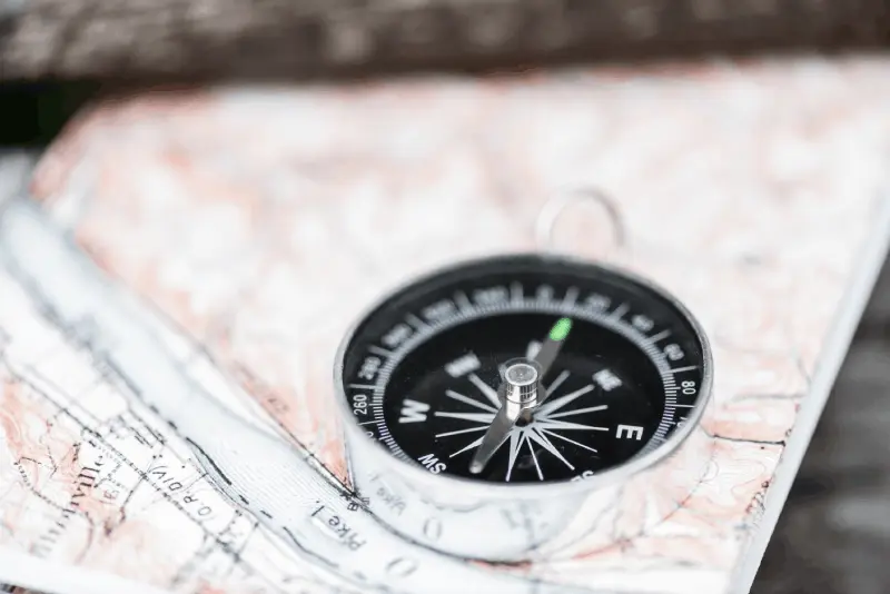
Spending time in nature can be very peaceful, but the thought of losing your way is one of the biggest sources of stress for many campers. Map reading skills are not only about getting from one place to another, but also about understanding the language of the geography you are in. When you can see elevations, valleys, and water sources on a map, your control over your surroundings increases. This control brings along self-confidence. Panic is the biggest cause of mistakes made in nature; however, when you know exactly where you are, your stress level decreases and you can make rational decisions. Therefore, map knowledge is not just a technical requirement, but also a mental defense mechanism.
How Do Contour Lines on Topographic Maps Bring the Terrain to Life in Your Mind?
The most characteristic feature of topographic maps, the contour lines (isohypses), allow you to construct a three-dimensional world on a two-dimensional sheet of paper. The closeness of these lines indicates steep slopes, while their distance represents flat areas. For campers, being able to read these lines means being able to predict the difficulty level of the path in advance. For example, closely spaced lines may indicate a steep ascent or a difficult wall to climb. When you can visualize these lines in your mind like a model, you can plan how to expend your physical energy. An individual who practices reading contours can easily determine their location based on the shape of the surrounding hills, even in situations where visibility is low.
What Risks Arise from Relying Solely on Technology Without Compass and Map Compatibility?
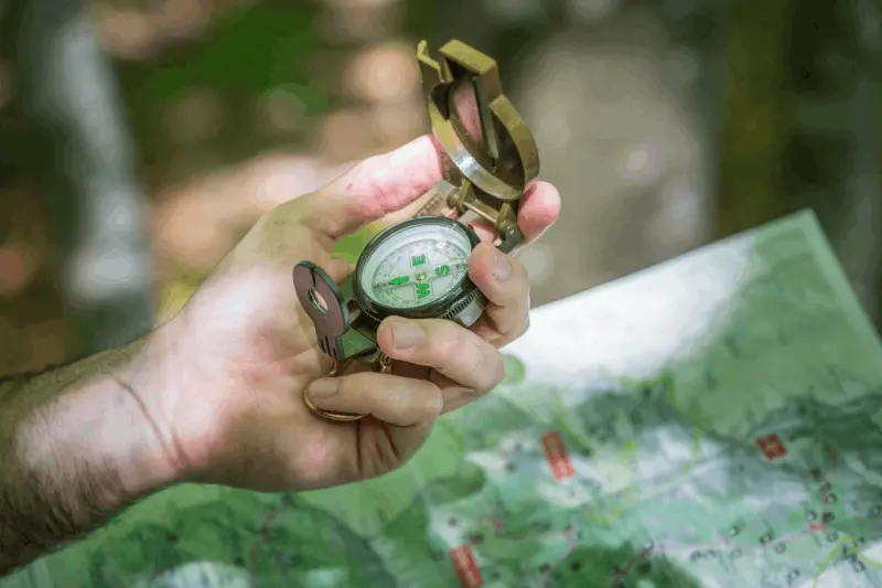
While GPS devices and smartphone applications have made navigation quite easy in the modern age, technology always carries the potential for failure. Dead batteries, rapid depletion of batteries in cold weather, the device falling into water, or loss of signal under dense tree cover can leave campers vulnerable. A camper who relies solely on digital data will be completely "blind" when their device fails. However, a map and compass require no charging and do not search for signals. The ability to use these traditional tools is your most reliable insurance in nature. A person who knows how to navigate using analog methods can determine their route even when digital systems fail and can safely reach their campsite or evacuation point.
What Are the Routing Errors Made Without Calculating the Magnetic Deviation Value?
Maps are drawn according to geographic (true) north, while compasses point to magnetic north. The angular difference between these two norths is called magnetic deviation (declination). If a camper applies an angle on the map directly to their compass without accounting for the deviation value of the area they are in, they can be hundreds of meters off target over a route that spans kilometers. Especially in long-distance hikes, this small angular difference can cause you to completely miss the water source or campsite you need to reach. This error can pose life-threatening risks in foggy weather or during night hikes. Adjusting for declination as a niche skill is an integral part of a professional camper's navigation discipline.
How Are the Positions of Stars and Navigation Techniques Used During Night Hikes?
After the sun sets, nature takes on a completely different identity, and familiar landmarks disappear. In this situation, the sky becomes your greatest navigation tool. Finding the North Star (Polaris) in the Northern Hemisphere is the oldest method of determining north. However, it is not enough to just look at the North Star; you need to fix your route on the map according to the positions of the stars, which means "taking a bearing." When you choose a specific star as a reference point while walking, you should also remember that the stars shift due to the rotation of the Earth. This technique provides you with a silent and endless guide when your flashlight fails or when you need to conserve battery. Night navigation is one of the most advanced levels of map reading skills.
How Can You Maintain Your Sense of Direction When Visibility is Reduced in Foggy Weather?
Fog is the most insidious obstacle in nature because it eliminates depth perception and makes every direction look similar. In such situations, the technique of "dead reckoning" comes into play. This technique allows you to estimate your current position by recording which direction you went, how fast, and for how long from your last known location. When combined with methods of counting steps or timing on the map, it allows you to progress even when visibility is nearly zero. Additionally, you should continuously take micro-bearings with your compass to ensure you are moving in a straight line. The ability to navigate in fog requires complete trust in the symbols on the map and the compass needle without panicking.
Why is Reading the Structure of Valleys and Slopes Essential for Finding Water Sources?
Finding water in the wild is the first rule of survival, and maps provide you with hidden clues in this regard. The contour lines shaped like a "V" on topographic maps often indicate a valley or streambed. If the tip of this "V" points to a high elevation, the likelihood of water flowing down from that valley is high. Campers can determine which valleys may be dry and which may hold water year-round by combining plant cover and elevation data while reading the map.
They can analyze. Instead of randomly wandering to reach water, following the drainage basins on the map saves energy and helps in strategically determining the campsite correctly.How to Analyze Wind Direction and Geographic Obstacles in Campsite Selection?
A good campsite is not just a flat ground; it is also a shelter against natural events. By analyzing the prevailing wind direction on the map, you can identify areas that are sheltered behind a hill or wooded area (downwind). Points where valleys narrow can accelerate the wind (Venturi effect), so it is necessary to avoid such narrow passes on the map. Additionally, you should check how high you are above riverbeds by looking at the water levels on the map to assess the risk of sudden flooding. Map reading is an analytical tool that tells you in advance whether the place where you will set up your camp will remain safe and comfortable throughout the night.
What is the Critical Impact of Seasonal Changes on Navigation Strategies?
Paths that are prominent in summer can completely disappear under snow in winter, or fallen leaves in autumn can obscure ground markers. Map reading skills teach you to focus on "landforms" that remain unchanged despite these variable conditions. Even if a riverbed is covered in snow, the valley structure on the map is still there. The changing angle of sunlight according to the seasons is also critical for navigation; in winter, the sun rises and sets further south, affecting shadow lengths and directions. Campers should interpret their maps with seasonal data (snow depth, frost risk, vegetation density). This niche perspective allows you to move with the same competence in nature every season.
How is Integration of Tracking and Natural Signs with Map Data Achieved?
Nature is full of signs; the mossy sides of trees, the speed of snowmelt, or the nests of snow ants provide general directional information. However, these natural signs are not always 100% reliable and are influenced by local conditions. True professionalism is combining these natural signs with the big picture on the map. For example, observing tilted trees due to the prevailing wind direction and corroborating this with the ridge structure on the map ensures your location. Map data organizes scattered information from nature and minimizes your margin of error. This integration is the deepest form of dialogue that the camper establishes with their surroundings.
What is the Role of Navigation Skills in Group Psychology in Team Leadership?
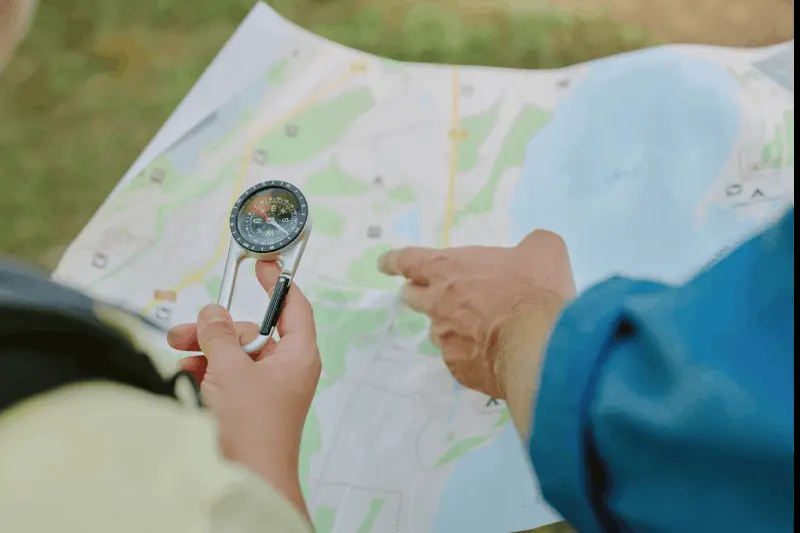
In group camping, the competence of the person determining the route and knowing the direction affects the morale of the entire group. If the leader does not know where they are or hesitates in reading the map, unrest and insecurity begin within the group. Conversely, a leader who is proficient with the map and anticipates obstacles (closed paths, steep slopes) while offering alternatives keeps the group's motivation high. Navigation is not just a technique; it is also a management skill. While ensuring the safety of the group, you must also convey your control over the map to manage the members' anxieties. This will enhance the enjoyment your camping friends derive from nature.
Why is Map Reading Practice Important When Preparing an Emergency Evacuation Plan?
In the event of an accident or sudden illness, knowing the fastest way to the nearest settlement or a point accessible by rescue teams can save lives. Map reading is not just about moving forward; it is also about knowing the "escape routes." Emergency evacuation routes should be determined on the map before setting up camp. Which valley descent is easier? Which ridge line is suitable for helicopter landing? Where is the nearest forest road? The answers to these questions are hidden on the map. Instead of rushing in the wrong direction in a panic during an emergency, using the data on the map to follow the safest and fastest route significantly increases your chances of survival.
How to Interpret Habitat Signs on the Map to Avoid Wild Animal Areas?
Maps not only show physical landforms but sometimes indirectly indicate ecosystems as well. For example, wetlands, dense forest cover, or steep cliffs are habitats for certain animal species. By reading the vegetation cover symbols on the map, you can see how far you are from riverbanks or fruiting areas where bears or other wildlife may be abundant. Similarly, when choosing your campsite, you can predict whether you are on animal migration routes based on the terrain (narrow passages, water troughs). Map reading helps you respect the inhabitants of the wild and reduces your risk of unwanted encounters with them.
What is the Effect of Elevation Change on Time Management and Hiking Speed Calculations?
There is a massive difference in time and energy between hiking 5 kilometers on flat ground and hiking 5 kilometers while gaining 1000 meters in elevation. The calculation of your "total elevation gain" using the contour lines on the map determines when you will arrive at camp. You can time your route on the map with simple calculations like the Naismith rule (1 hour for every 5 km + 1 hour for every 600 m of ascent). This skill is critical for reaching the campsite before dark. Incorrect timing can lead you to stay in difficult terrain in the dark. Analyzing the terrain difficulty on the map helps you manage your physical limits accurately.
How to Overcome Battery and Signal Issues in Using Digital Maps?
Even when using digital navigation, it is necessary to understand the logic of map reading. Keeping your phone in "airplane mode" and "power-saving" extends battery life, but this is not enough. The downloaded offline maps are essential for navigation. To be able to relate the terrain to physical locations, you need to have basic topography knowledge. Additionally, it is necessary to understand the effect of screen brightness on navigation and the calibration of the compass sensor. Digital tools are aids, but it is the human mind that interprets their data. By adopting a hybrid approach, combining the digital convenience with analog safety nets is the smartest way to modern camping.
What Are the Benefits of Teaching Navigation Skills to Children and Beginners in Future Camps?
Learning navigation skills at a young age or at the beginning of camping fundamentally changes one's awareness of nature. Teaching a child to use a compass is not just about giving them a tool, but teaching them to observe the world around them carefully. This education triggers curiosity and develops self-confidence. For beginners, learning to read a map helps them see nature not as a random greenery but as a maze waiting to be discovered. In future camps, the ability of these individuals to move more independently and safely positively affects group dynamics. Navigation training can be extended to outdoor sports and opens the door to conscious participation.
How to Determine Safe Areas on a Map During Natural Disaster Moments?
At any moment in nature, one may encounter extreme situations such as floods, landslides, or forest fires. When such a moment occurs, instead of panicking and fleeing, it is vital to look at the map and identify high and open areas (for fire) or ridges away from the floodplain (for floods). Identifying points on the map such as "dominant hill" or "safe plateau" gives you a target amidst the chaos. A mind that can read geography can predict the nature of the disaster and which direction to head. For example, if a flood is coming in a valley, identifying the nearest and least steep escape point on the map allows you to make decisions within seconds.
What Are the Techniques for Micro Location Determination in Flora and Fauna Observation?
Some rare plant species or animals only live within a specific altitude range, at a certain slope, and in a specific direction (relative to the sun). Reading a map helps you find these niche points. North-facing slopes (in the Northern Hemisphere) tend to be more humid and shaded, while south-facing slopes are drier and sunnier. If the plant you are looking for only grows on moist north-facing slopes, you can conduct a target-focused exploration by filtering these areas on the map. This method provides invaluable time savings for nature photographers and researchers. A map is not just a roadmap; it is also an ecological guide.
Why Is It Exciting to Trace Ancient Roads and Old Trails on Maps?
Many modern maps still contain traces of ancient caravan routes, old trails, or abandoned settlements. As your map reading skills improve, you begin to notice that the faint lines on the paper could be historical routes. These paths often traverse the most logical and least resistant points of the terrain. Following an old trail not only makes your camping journey more comfortable but also offers you a cultural discovery opportunity. The map connects you with the travelers of the past by building a bridge over time along the same route. This depth transforms the camping experience from a simple stay into an epic journey.
What Should Be Considered in Equipment Selection from Map Pocket to Compass Quality?
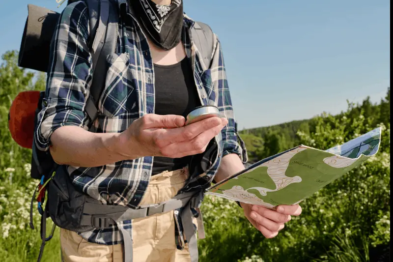
For accurate navigation, knowledge alone is not enough; quality equipment to apply this knowledge is also essential. Having a "liquid-damped" compass ensures that the needle stops quickly and reduces reading errors. Your map should be printed on waterproof paper or stored in a transparent map case to prevent your route from washing away in rainy weather. Additionally, your backpack should have accessible pockets for the map and compass at all times. The quality of the equipment supports your confidence under challenging conditions. A cheap and low-quality compass can mislead you into greater dangers by showing the wrong direction. Therefore, equipment selection is the first physical step in the discipline of navigation.
What Is the Effect of Micro Topography Data on Camping Comfort?
Sometimes small dips or bumps (micro topography) that are not visible on a general map but are noticeable on-site determine the quality of your sleep at night. However, someone who reads the map well can predict whether they will enter the water's path by knowing where the general slope is directed. The structure of the soil (rocky, sandy, muddy) can provide clues with symbols on the map. For example, camping near an area marked with swamp or marsh symbols invites a mosquito invasion. Map reading is not only used to reach large goals but is also a tool used to optimize the small details and comfort of camping life.
How Are Magnetic Field Disturbances and Local Deviations Noticed on the Compass?
A compass does not always point true north; it can be affected by nearby metal objects, energy lines, or the concentration of iron ore in the area. A professional camper should be able to notice the "erratic" movements of the compass needle. In such cases, it is necessary to move away from objects affecting the compass or to focus entirely on the landforms on the map to perform "visual navigation." Compass deviation is not only related to geographic declination; it can sometimes be related to a local anomaly. Being able to notice this is a niche area where map reading skills are blended with experience. Instead of relying blindly on the device, the safest way is to always verify the data with environmental conditions.
How Are the Concepts of "Handrail" and "Catching Feature" Applied in Hiking Routes?
In navigation, the techniques of "handrail" and "catching feature" minimize the risk of getting lost. There are two strategic elements. If you are following a stream, a forest path, or a distinct ridge line, this is your fear; even if you stray far from the route, you can return to it. The "catching feature" is a significant geographical marker that will stop you when you deviate from your target. For example, being able to say, "If I cross this valley and reach the large lake, it means I have strayed 1 kilometer from my target" alerts you. Identifying these safety barriers in advance while reading a map is like putting on a mental seatbelt. These techniques make navigation more structured and less prone to error.
How to Conduct a Detailed Analysis of the Color Codes and Symbols on a Map?
Maps are silent books, and every color, every line carries meaning. Green areas represent vegetation cover, brown lines indicate landforms, blue sections represent water, and black or red lines represent man-made structures. However, not every green means "traversable forest"; it can sometimes indicate very dense thickets (macchia). Knowing the legend (key) of the map by heart allows you to understand its character without seeing the terrain. For a camper, a small black square on the map (a shelter or a ruined wall) can be a lifesaving refuge. A detailed analysis of symbols is the translation process that turns the data on paper into real land knowledge.
How to Plan Routes and Determine Logistics Support Points in Long-Term Camps?
In long camps lasting weeks, reading a map is not just a tool for finding direction; it is also a major logistics planning center. Points where you can replenish water, the nearest settlements where you can obtain fuel or food, and emergency evacuation points should be marked on the map in advance. The distance to be covered each day should be realistically calculated according to the terrain's slope. This planning prioritizes physical endurance. Identifying "strategic camp points" on the map ensures that you spend each night as safely as possible by considering factors like wind and water. Good planning starts at the beginning of the map.
What Are the Reasons Why Navigation Skills Are Crucially Important for Solo Campers?
When you go camping alone, there is no one beside you to consult or to warn you when you make a mistake. In this case, your margin for navigation error is zero. For a solo camper, a map and compass are their most loyal companions. Continuously confirming your location and marking your route on your daily log or map helps maintain mental discipline. Entering a wrong detour poses a much greater risk and source of panic for someone alone. Therefore, solo campers should elevate their map reading skills to the highest level and minimize their dependencies on technology. The foundation of self-sufficiency lies in knowing exactly where you are.
What Are Common Mistakes Made in Map Scale and Distance Estimations?
Not understanding the difference between a 1:25,000 scale map and a 1:100,000 scale map is one of the most common mistakes made by campers. Small scale maps show broad areas but hide details. Large scale maps are ideal for navigation and direction finding. Quickly calculating how many meters correspond to 1 centimeter on the map allows you to accurately estimate how much distance remains to your target. Estimations made by eye can often be misleading; as fatigue increases, distances appear longer. Using the scale on the edge of the map or the compass eliminates these subjective errors and provides you with objective data.
How to Transfer GPS Data to the Coordinate System on a Map (UTM, Latitude/Longitude)?
When your digital device gives you a coordinate (for example, 36S... or 40°N...), being able to mark this on a physical map is an advanced navigation skill. The UTM (Universal Transverse Mercator) grid system simplifies making metric measurements on the map, while latitude/longitude degrees provide a spherical reference. If you cannot accurately transfer this data to the map, the GPS remains just a collection of meaningless numbers. Using these formats correctly when reporting your location to search and rescue teams can reduce their response time by hours. Understanding coordinate systems is about merging a local map with a universal language.
What Is the Art of Correctly Interpreting the Movements of the Compass Needle and "Swinging in the Liquid"?
The biggest mistake made when using a compass is not keeping it perfectly horizontal or not allowing the needle to turn freely. The role of the liquid in the compass housing is to slow down the needle and prevent vibration, but in cold weather, this liquid can become viscous, causing the needle to slow down. A professional camper knows to slightly shake the compass or check from different angles to ensure the needle is sitting correctly and pointing north. This "sensitive touch" is especially critical in areas with metal interference or while on the move. Understanding the language of the device begins with knowing its technical limits.
How Can You Practice Map Reading Skills in Urban Life and Daily Walks?
Navigation skills are like a muscle; they weaken when not used. You can develop this skill not only in camps you visit once a year but also in daily life. Using city maps to match the streets on paper with the real world keeps your sense of direction alive. Practicing compass bearings in parks or wooded areas helps you see your margin of error. Even turning off navigation apps and trying to reach an address using only the map in your mind is excellent training. These small exercises done before heading into nature develop the reflexes you need in a real adventure moment.
Why Is Reading Nature's Language Through Maps a Way of Life?
Finding direction and reading maps is not just a camping technique; it is also about understanding humanity's place in nature. nlama is a skill. A person who possesses this skill becomes not just a tourist but a true part of nature. Being able to read geography, elevations, and distances is like learning a universal language. This competence grants you freedom; for you are not afraid to stray from the path, seeing every obstacle as an opportunity for discovery. The time you spend on maps and compasses in your camps is, in fact, an investment in your own safety and the deep bond you create with nature. Remember, a person who knows where they are is never lost; they simply continue to explore.